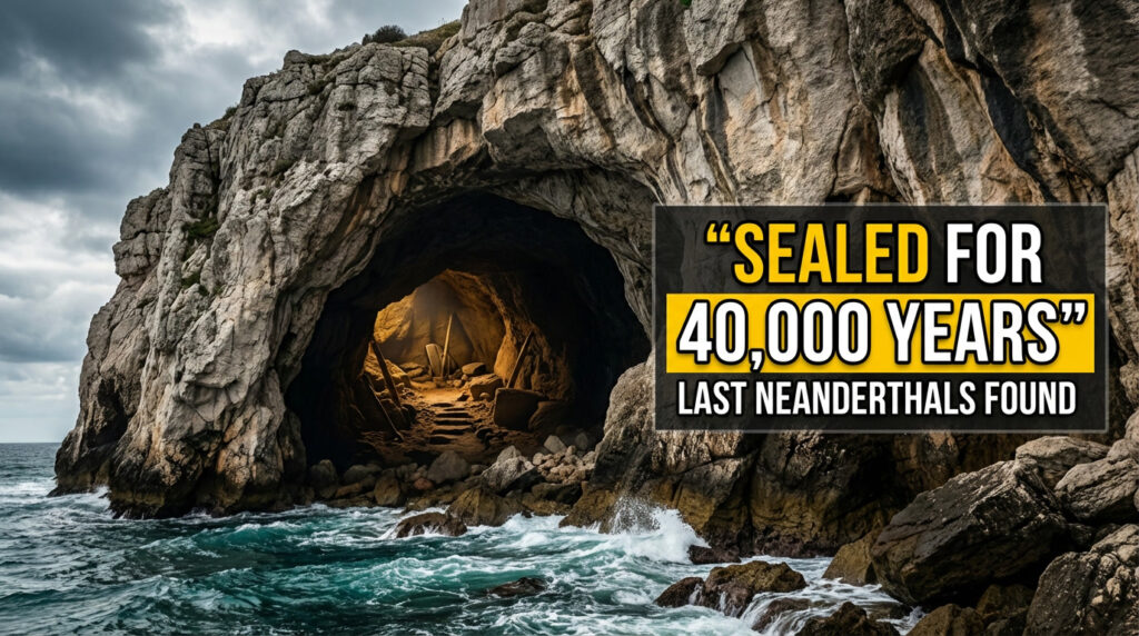
At first, it looked like a mirage — a smear of beige against the heavy blue of the South China Sea. Then the shape sharpened into roads, radar domes, a runway cutting dead straight across what, a decade earlier, had been nothing but water. The air smelled of diesel, hot metal, and wet salt. Seabirds circled above concrete breakwaters that hadn’t existed on any map when today’s recruits were still in primary school.
The captain didn’t bother to hide his awe. “This was open ocean,” he muttered, half to himself, half to no one. “Nothing here.” Now there were floodlights, cranes, a helipad, and a line of young trees struggling to survive in imported soil — all of it resting on sand that had once lain quietly on the seabed.

For 12 years, China has been dumping that sand into the ocean, turning shoals into islands and empty reefs into fortified outposts. The question gnawing at everyone nearby is simple, even if the answers aren’t.
How China turned empty reefs into solid ground
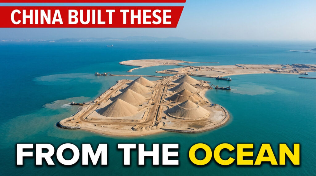
On satellite images, the transformation looks almost like time-lapse magic. One year you see a bleached ring of coral, barely breaking the surface at low tide. A few years later, there’s a bright, geometric splash of white and grey, edged by straight lines that only humans draw. Engineers call it “land reclamation.” Locals, watching their fishing grounds shrink, tend to use harsher words.
China focused on a scattering of reefs and low-tide elevations across the Spratly Islands, in one of the world’s most contested seas. Dredgers scooped up sand from the seabed and pumped it onto these fragile structures, building them up layer by layer. The speed was stunning. In some places, what looked like a smudge in 2013 had become a runway-ready, three-kilometre strip by 2016. That’s not just construction. That’s rewriting the map.

Between 2013 and 2016 alone, Chinese crews created more than 1,200 hectares of new land in the Spratlys — roughly the size of 1,600 football fields, conjured out of saltwater and sediment. Mischief Reef, previously a name known mainly to sailors and lawyers, now hosts long airstrips, hangars, and radar equipment. Fiery Cross Reef, once a lonely, wave-smashed outcrop, has become a full-blown island with deep harbours, fuel storage, and hardened shelters.
Officially, the build-up was framed as supporting “civilian facilities,” rescuing ships and aiding navigation. On the ground — or rather, on the fresh concrete — the mix tells a different story. Lighthouses share space with anti-aircraft batteries. Weather stations sit next to radar domes. At first glance, the islands resemble any modern Chinese city district: neat roads, white buildings, cell towers. Then you notice the missile platforms.
The engineering logic behind these islands is simple, even if the geopolitics are not. If you want a military or logistical foothold far from your natural coastline, you need hard, stable ground. Natural islands are rare and fiercely contested in the South China Sea. Sand, though, is everywhere. Dredgers carve channels into the seabed, sucking up sediment and blasting it onto selected reefs. Bulldozers then push, flatten, and compact the new material, while rock and concrete walls hold it in place against waves and storms.

Once the outline is fixed, the real work begins: foundations for buildings, power plants, desalination units, fuel depots. Soil is shipped in for planted trees and a thin layer of “green.” What looks like an island is, in reality, a carefully engineered platform, constantly fighting erosion, salt, wind, and time — an island on life support.
Behind the technical jargon sits a blunt strategic idea: the more permanent structures you have in the water, the more you can claim as yours. That’s where the argument really starts.
Why those artificial islands matter far beyond the South China Sea
If you want to understand why anyone would spend years pouring sand into the ocean, watch a fishing boat weave nervously near the new coastlines. The South China Sea isn’t just a patch of blue on a wall map. It’s a lifeline. An estimated one-third of global shipping passes through these routes. The seabed may hold billions of barrels of oil and vast gas reserves. For the Philippines, Vietnam, Malaysia, and others, this is dinner on the table and fuel in the tank.
China’s man-made islands sit like hard points on a soft canvas. From them, coast guards, naval vessels, and aircraft can monitor — and sometimes challenge — anything passing by. The message is subtle only if you want it to be: this is our neighbourhood now. Soyons honnêtes : personne ne fait vraiment ça sans penser au pouvoir que ça donne. Each new radar dome or pier turns vague “historic rights” claims into steel-and-concrete reality.
On a clear day, standing on one of these newborn islands, the outlines of tension are everywhere. A Philippine supply boat, rusty but stubborn, pushing provisions to its grounded ship at Second Thomas Shoal. A Vietnamese trawler steering a little wider than it used to. A U.S. Navy destroyer cruising just outside the lines China says are off-limits. On radar screens and AIS trackers, the dance looks like a slow-motion argument played on repeat.
The environmental cost hides under the waves, where cameras rarely linger. To create flat, stable platforms, dredgers scoured the seabed around reefs, suffocating corals with plumes of sediment. Marine biologists speak of entire reef systems scraped, buried, or smothered. Fish lose their breeding grounds. Turtles lose their feeding spots. And once a fragile reef is stripped and loaded with concrete, there’s no easy way back.
We’ve all had that moment when a familiar place becomes unrecognisable — an old field turned into a car park, a shoreline crowded with concrete. Scale that up to a whole sea and it’s easier to understand why neighbouring countries are nervous. These aren’t holiday islands. They’re launchpads.
From Beijing’s point of view, the logic runs differently. China argues these features were always theirs and that building on them is no more dramatic than extending a pier. Officials insist the projects are defensive, meant to secure trade routes and protect what they see as sovereign territory. In a world where supply chains feel fragile and threats feel closer, the urge to turn water into land — and land into leverage — becomes tempting.
The rest of the region doesn’t see it that way. To them, every new metre of reclaimed land is a fresh claim pressed into the sea like a flag in wet sand. The risk isn’t just more arguments in conference rooms. It’s miscalculation: a radio warning misheard, a ship turning left instead of right, a pilot flying too low over the wrong strip of “new” land.
Can the world live with man-made islands like this?
There’s no magic off switch for a concrete island once it’s there. Governments, navies, and even ordinary citizens are quietly learning how to live with this new geography. One practical response has been relentless monitoring. Commercial satellites pass overhead daily. Open-source analysts comb through imagery, tracking each new hangar, each fresh layer of sand, each ship docking where no ship could dock before.
From thousands of kilometres away, this may sound abstract. But this watchfulness is how escalation is spotted early. When a new radar dome appears, when a runway is lengthened, when air-defence systems pop up on a reclaimed beach, it signals intent. It’s less dramatic than patrol boats and speeches, yet oddly more powerful: a quiet, factual record of what is really changing on the water.
Another response has been legal and diplomatic, a game played in conference halls rather than coral shallows. In 2016, an international tribunal in The Hague ruled that many of these features — even built up — do not generate vast exclusive economic zones. Under international law, a pile of sand on a reef does not equal a full island with sweeping rights. Beijing rejected the ruling outright, but it remains embedded in legal briefs and policy papers — a slow-burning counterweight to concrete.
For people who live around the South China Sea, daily reality is less about court rulings and more about survival. Fishermen are told to stay away from waters their grandfathers once worked freely. Coast guard ships shadow small wooden boats. Some adapt by changing routes or investing in sturdier vessels. Others quit entirely. The emotional cost is harder to measure than hectares of reclaimed land, but no less real.
There are common mistakes in how we think about these islands. One is treating them as unstoppable. They’re not. Salt, storms, and subsidence attack concrete relentlessly. Maintaining these outposts will be an endless, expensive chore. Another mistake is assuming only one country will ever do this. From Dubai’s palm-shaped islands to airport extensions in Japan and Hong Kong, ocean engineering is spreading. The motive here is sharper and more strategic, but the technique is not unique.
It’s also easy to forget the people who live and work on these artificial specks of land: technicians spending months away from home, young conscripts pacing the same few roads under a bleaching sun, pilots taking off from runways where waves once broke. Their experience doesn’t appear on satellite photos, yet it shapes how these places function. Fatigue, boredom, overconfidence — these are risk factors too.
“We built these islands to make us feel safer,” a security analyst in Manila told me. “But each one also feels like a new tripwire. The more hardware you place on shifting sand, the easier it is for something to snap.”
That tension — between safety and risk, power and fragility — defines the whole story. A few points are worth keeping in mind:
- These islands are both strong and fragile: politically hard to dismantle, physically under constant stress from the sea.
- Maps lag behind reality: what your school atlas shows as open water may now host a runway and radar stations.
- Conflict isn’t inevitable: restraint, transparency, and unglamorous diplomacy matter more than dramatic gestures.
A new kind of coastline, and the questions it leaves behind
The South China Sea is no longer just a patchwork of natural islands, reefs, and invisible borders. It is now dotted with structures that didn’t exist a generation ago — slabs of engineered land blurring the line between nature and infrastructure. In just over a decade of pouring sand and money, China has shown that coastlines are not as fixed as we once thought. Raise an island from a reef, and you can shift shipping routes, fishing grounds, and military lines without moving a single mountain on land.
For everyone else, that raises uncomfortable questions. How do you negotiate with territory that can be manufactured? What happens when climate change erodes natural shores while artificial ones expand? Who pays for damage to ecosystems nobody voted to destroy? These aren’t abstract debates. They ripple into supermarket prices, fuel bills, and even the fish that ends up on a plate in a city far from any sea.
FAQs:
Are China’s artificial islands legal under international law?
Their legality is heavily disputed. In 2016, an international tribunal in The Hague ruled that many of the features China has built up do not generate extensive maritime rights under international law. China rejected the ruling and does not recognise its authority, continuing to operate the islands as if they were legitimate sovereign outposts.
Can these man-made islands sink or wash away?
They are engineered to withstand waves and storms, but they are not permanent in a natural sense. The islands face constant erosion, subsidence, and storm damage. Keeping them stable requires continuous maintenance, reinforcement, and significant financial investment.
Why build military facilities so far from the Chinese mainland?
The islands dramatically extend China’s reach. From runways, ports, and radar sites in the Spratly Islands, Chinese forces can monitor — and potentially control — busy shipping lanes and disputed waters much more directly than from the mainland.